Nepal Illustrated Map
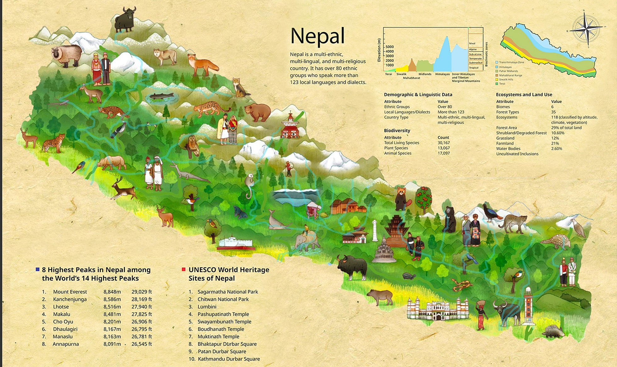
WaterComm was commissioned to create a 72 x 36-inch detailed illustrated map of Nepal—a vibrant visual tapestry of the country’s rich natural and cultural heritage.
This large-format artwork was carefully crafted to represent the biodiversity, cultural landmarks, UNESCO World Heritage sites, major rivers, and iconic mountain ranges that define Nepal’s landscape from east to west. Designed for both educational and promotional use, the map combines scientific accuracy with artistic storytelling, making it both informative and visually captivating.
Every element—from the snow-capped peaks of the Himalayas to the dense jungles of the Terai, from sacred temples to traditional villages—was hand-illustrated with cultural sensitivity and attention to detail.
WaterComm transformed geographical data into an engaging, story-rich visual experience that celebrates Nepal’s identity—educating viewers while deepening emotional and cultural connection.


Are you in touch with your brand?
At WaterComm, we help our clients build innovative and inspiring brand that are genuinely rich, powerful, relevant with lasting customer relation.